- Home
- Photography Tours
- Diary / Blog
- Galleries
- Foreign Trips
- Tasmania 2016
- NE Queensland 2016
- Western Alps 2016
- NE Spain 2016
- Australia's Wet Tropics 2015
- Australia's Top End 2015
- SW Australia 2015
- Switzerland 2015
- Andalucia 2015
- Belize 2015
- Australia 2014
- Switzerland 2014
- Belize 2014
- Bahama Islands 2014
- Switzerland 2013
- Ecuador 2012-2013
- Florida 2011-2012
- Vancouver Island 2011
- Australia 2010
- Peru 2008
- Bulgaria 2007
- Lesvos 2006
- California 2006
- New Zealand 2005
- Extremadura 2005
- Goa, India 2004
- The Gambia 2003
- About
November 2014
5th-6th November 2014
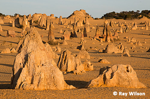
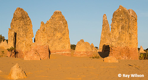
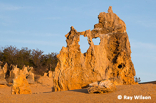
The Pinnacles, Western Australia
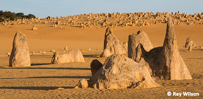
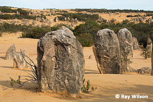
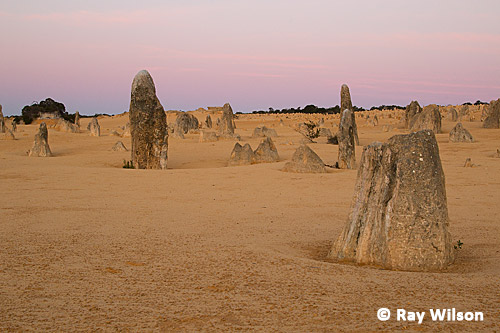
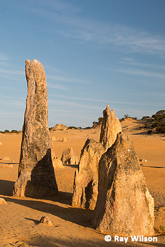
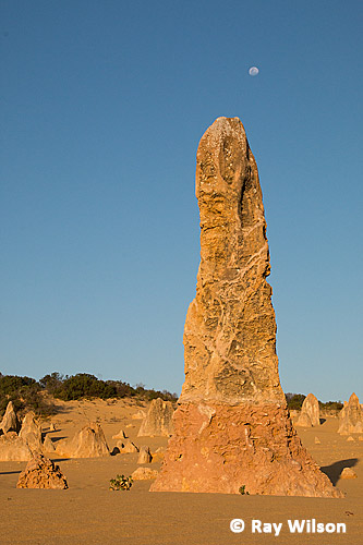
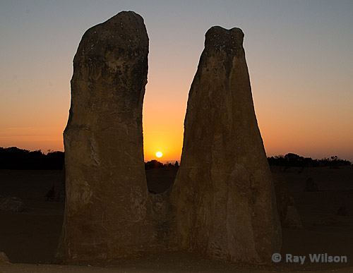
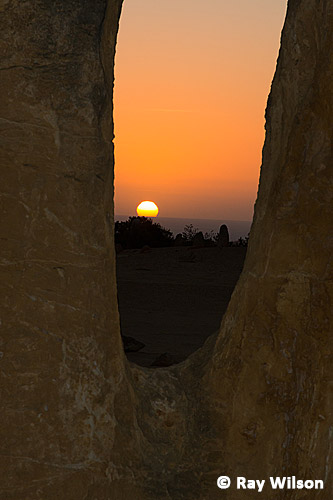
The spectacular limestone formations of "The Pinnacles", being only a 2 hour drive north of Perth, is, quite rightly, one of the most popular tourist attractions in Western Australia with over 250,000 visitors per year.
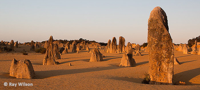
Covering an area of about 190 hectares, the Pinnacles comprises of thousands of naturally-formed pillars of aerolian calcarenite (a type of soft limestone formed by a combination of wind-blown calcium carbonate and rain) ranging in height from only a few centimetres to towering monoliths over 5m tall.
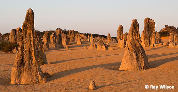
The currently most accepted theory of how the pinnacles formed can be briefly summarised as follows: First, huge sand dunes were stabilised by plant growth and rainfall slowly leached down through the sand, picking up quantities of calcium from the remnants of shells left by dead sea-creatures on its passage through the layers. Once it reached a saturating concentration, the calcium carbonate precipitated out of the water and formed a soft layer of limestone. As the plants continued to grow, a layer of soil was deposited on top of the sand, further compacting it and helping to harden the limestone. As time progressed and more soil was laid down, the lower layers of soil were compacted to form a hard cap above the limestone. Cracks in this cap and the limestone beneath were exploited by the plant roots as they drove deeper in their search of nutrients and the cracks were gradually widened, breaking up the hard cap of soil and the limestone. Over time, changes in the climate resulted in the area becoming more arid and the plant cover died off, destabilising the soil and allowing wind erosion to remove the surface so that the underlying pinnacles were eventually exposed.
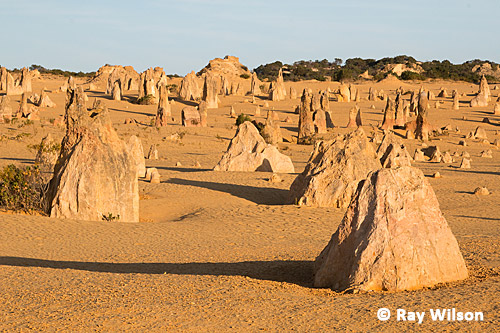
It is not known how long ago the pinnacles were formed and estimates range from just a few thousand years to 500,000 years ago.
 |
 |
 |
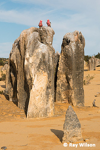
Galahs (Eolophus roseicapillus) resting on a pinnacle |
Wildlife is not hugely evident in the park, although the usual arid country residents such as Singing and White-lined Honeyeaters, Chestnut-rumped Thornbills and, of course, the ubiquitous Galah, can found without too much effort.
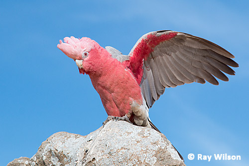
Galah (Eolophus roseicapillus)
Western Grey Kangaroos are also fairly regularly seen feeding on the sparse vegetation between the pinnacles.
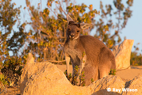
female Western Grey Kangaroo (Macropus fuliginosus)
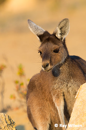
female Western Grey Kangaroo (Macropus fuliginosus)
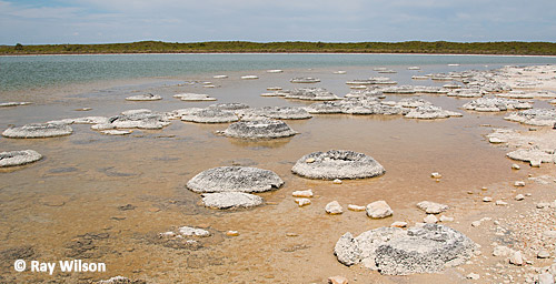
Stromatolites at Lake Thetis
Nearby at Cervantes, the marine lake of Lake Thetis is one of the few places in the world where living stromatolites can be found. The circular limestone rock formations here at Lake Thetis have been laid down over the last 3500 years by the mats of cyanobacteria that live on their surface and provide us with a window as to how the earth may have looked over 3 billion years ago when early forms of life were just beginning to emerge on the planet.
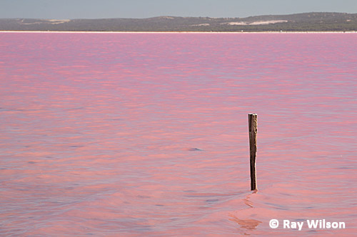
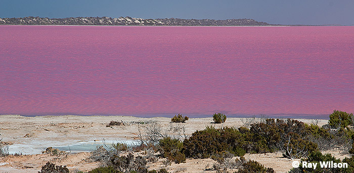
Pink Lake at Port Gregory
During the summer months some of the lakes at Port Gregory develop a distinctive pink colour. This is due mainly to the green alga Dunaliella salina which accumulates beta carotene, a red pigment, within its cells once the water temperature rises and evaporation causes the salinity of the lakes to be raised well above that of sea water. The pink halobacterium, Halobacteria cutirubrum, that grow on the salt crust on the lake bed and high concentrations of brine prawn can also contribute to the colour of the lakes.
Pink lakes, such as the ones pictured here, are often important feeding sites for shorebirds, such as Banded Stilt and Red-necked Avocet and congregations numbering in the tens of thousands are not uncommon. At this lake, there was a flock of around 1000 Banded Stilts with a few Knots and Red-necked Stints in the shallower water, but they were all far too distant to photograph.
Pink Lake at Port Gregory
Ray Wilson owns the copyright of all images on this site.
They may not be used or copied in any form without prior written permission.
raywilsonphotography@googlemail.com